With over 330 parks, gardens and natural areas to discover across the region there are plenty of opportunities to enjoy the outdoors.
Keep active and healthy with a range of recreational opportunities including cycling, boating, bush walking, beach volleyball and bird watching.
There are plenty of playgrounds to keep the kids active, areas to walk your dogs and exercise equipment to use.
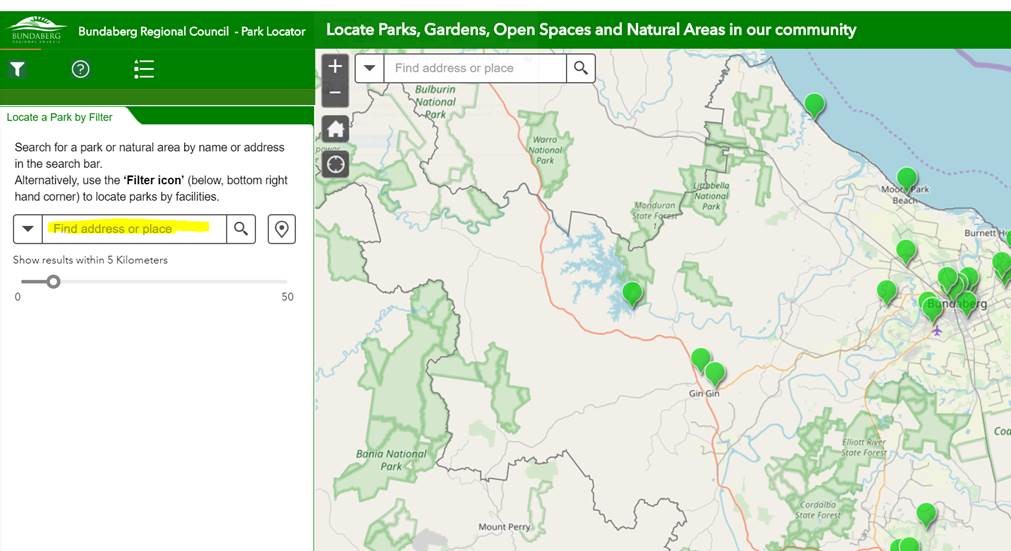
Park Finder is a convenient way to search for parks across the Bundaberg Region. A host of the region’s most popular park destinations are currently displayed. Park Locator is under development and when finalised will provide information on almost 250 parks across the region.
Find a park below:
View the map in full screen to use the GPS locator
Come and explore the beautiful wetlands at Baldwin Swamp Environmental Park or follow the boardwalk through the Hummock Reserve. Near the coastline, walk the sandy tracks and search for wildflowers in the Wallum Heath at Vera Scarth-Johnson Wildflower Reserve and meander through the Melaleuca wetlands and open plains of Barolin Nature Reserve.
With 12 natural areas to discover across Bundaberg, Childers and Gin Gin there are plenty of opportunities for bird watching, photography, picnicking and bush walking. Many of the reserves offer short walks and loop tracks less than 1km in length. There are also a number of longer walks up to 4km throughout the region.
Our natural areas include:
Bundaberg
- Avondale Reserve
- Baldwin Swamp Environmental Park
- Barolin Nature Reserve
- Sharon Gorge Nature Park
- Vera Scarth-Johnson Wildflower Reserve
- Riverview Environmental Reserve
- Heathwood Park
- Maureen Schmitt Park
- Meadowvale Environmental Reserve
Childers
- Russo Environmental Park
- Helms Scrub
Gin Gin
To discover more about each of our natural areas, recreational parks and reserves across the Bundaberg region, view our interactive park map below:
View the map in full screen to use the GPS locator
Help guide to using the Park and Natural Areas finder online map
Search by keywords
Search for a park or natural area by name or address, if you already have an idea of where you want to visit.

Search by filters
Set filters Using the "filter Icon" in the bottom right hand corner of this tab, to select and see what facilities each park or natural area has to offer.
Select which facilities you require, by ticking on a particular feature. The map will then only display those parks that contain that facility. i.e: tick barbecue to display all parks and natural areas across our regions that provide barbecues.
Note: You must “unselect” a particular facility filter before selecting another. If you select multiple filters, the map will only show parks that have all of the selected facilities available (eg. a barbecue and a picnic table).

Search by map
If you click on a particular park icon, on the map, it will display a pop up which will give you a detailed description of that park or natural area and will also show what facilities it does or does not contain.

Show your location or return home
You can show you current location on any device with a GPS, by clicking on the locate button in the top left hand corner of the map. Return to the home page, by clicking on the home button in the top left hand corner of the map. This will zoom you back to the overall extent of region again.
